
Our Services
Flood Risk Intelligence.
We combine hydrology, hydraulics, and GIS to assist insurance, engineering & government with quantifiable flood risk, actionable insights and mitigations that make a difference.
Scope & Data Check
Inputs from you
Site boundary, address or coords, drawings, surveys, scope & deadlines.
Base Data & Survey
We do
Assemble DEM, soils, land use, hydrology layers. Review existing survey and structures. Advise if new survey is needed.
Hydrology
We do
Select design storms, source rainfall & flow data, calculate design floods, calibrate models, produce peak flows and hydrographs. Sensitivity checks.
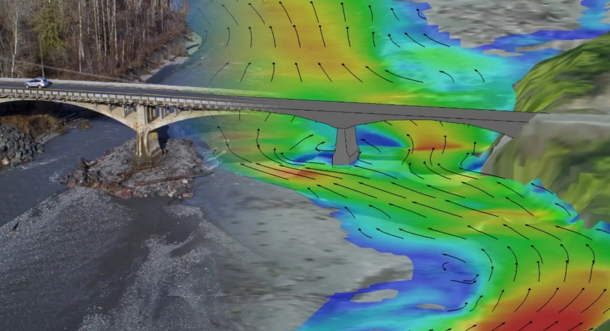
Hydraulics (1D/2D)
We do
Build 1D/2D models for riverine and urban flooding. Add hydraulic structures. Calibrate hydraulic model. Test blockages and scenarios. Sensitivity checks.
Options, Mitigation & Costs
We do
Generate and compare options. Size pipes, culverts, bridges, and dams. Include SuDS where feasible. Provide budget costs and priorities.
Reporting, Drawings & Handover
We do
Prepare report, drawings, and GIS/CAD files. Present to stakeholders. Set up an optional web map for viewing.
-
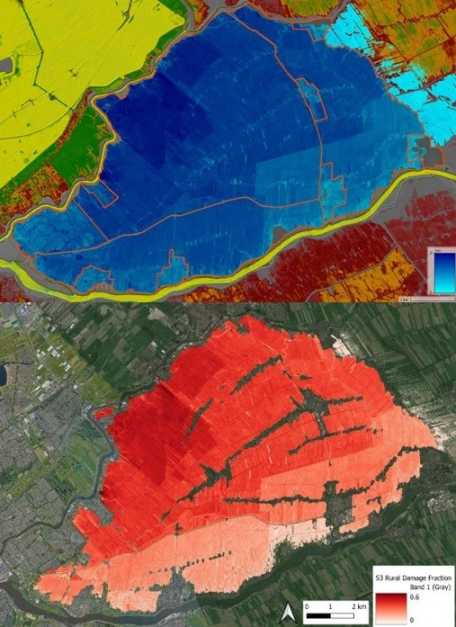
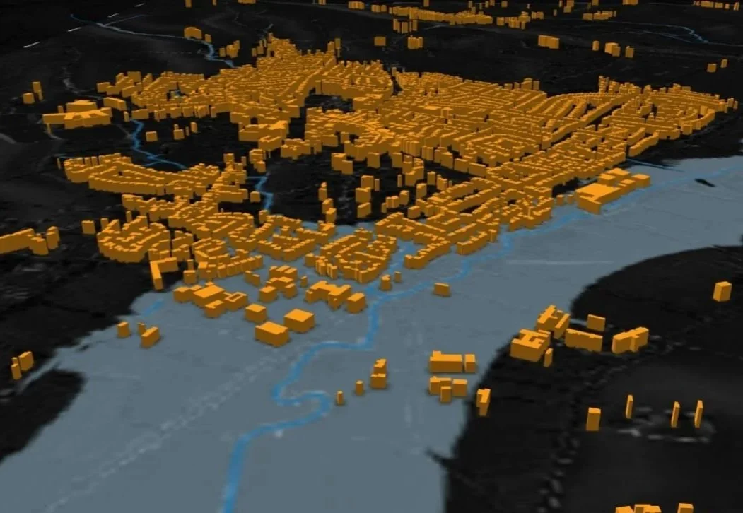
Flood Risk Intelligence & Catastophe Modelling
What we do
Portfolio screening, site-level risk scores, risk review, catastophe modelling, mitigation options and costs. -
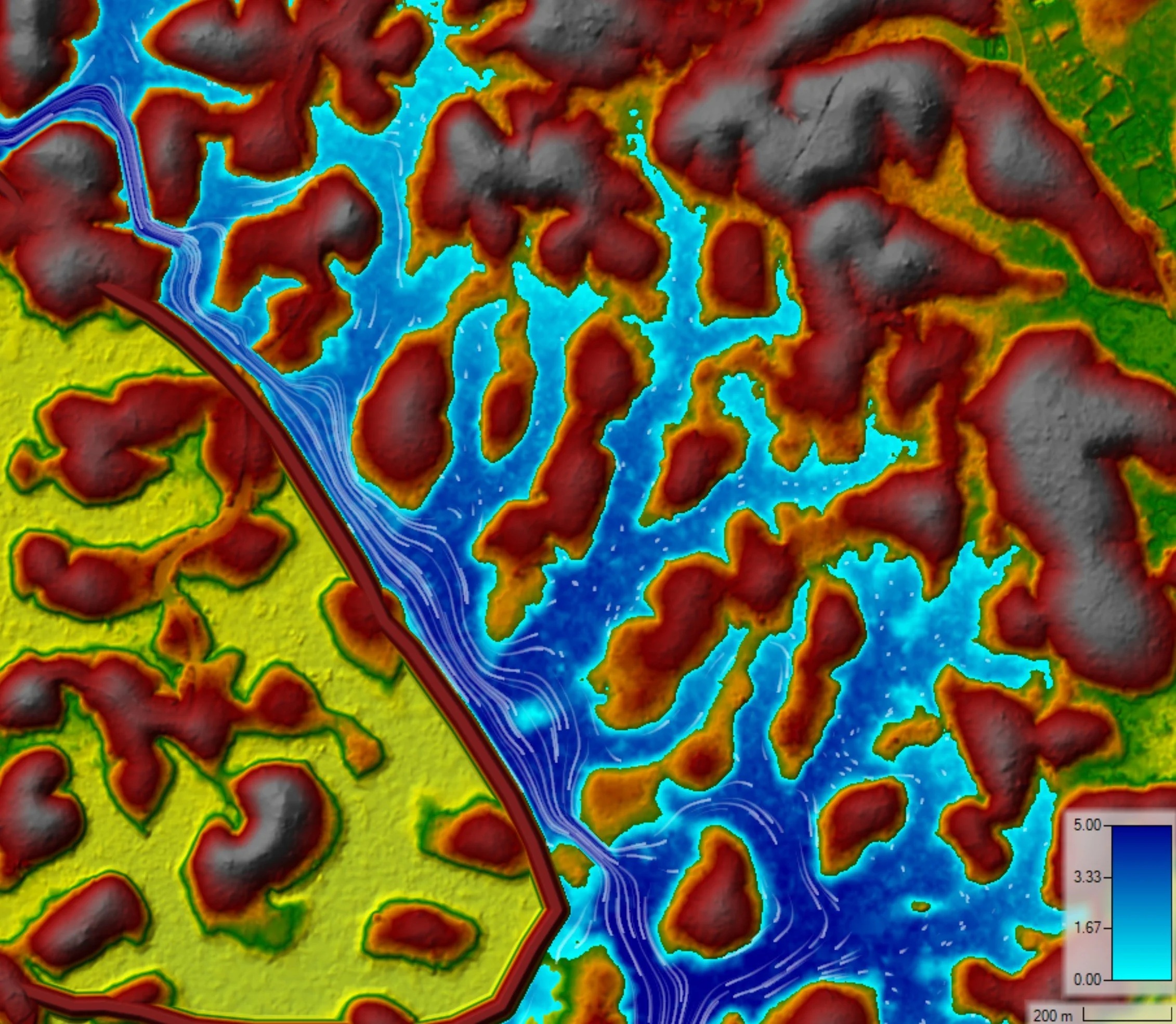
Floodline Modelling & Floodline Mapping
What we do
1D/2D modelling of river and pluvial flooding to produce floodlines, inundation extents, flood hazard outputs. -
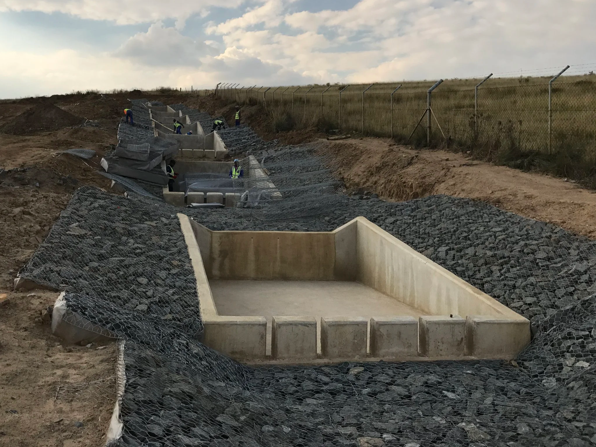
Stormwater & Flood Engineering
What we do
Canals, culverts, stream diversions, dams, SuDS. Full project lifecycle from concept, feasibility, detail design, tender, execution, project management & close out. -
Hydrological Studies
What we do
Catchment delineation, design rainfall, analysis of rainfall and flow data, design flood calculations, calibration of models, parameter sensitivity. -
GIS, Mapping & Data Delivery
What we do
CAD/GIS integration, web map viewers, WMS/WFS feeds, PostGIS delivery, photogrametry & lidar surveys, field data capture workflows. -
Hydrology & Hydraulics Training
What we do
PCSWMM & HEC-RAS Training: Stormwater networks, dual drainage, water quality, SuDS, integrated 1D/2D, pipe networks, dam breach, 2D bridges, rain on grid, RAS2025.